Government Completed 2024

Farmer Registration Mobile App

Mobile app for farmer household registration — capturing crops, machinery, and farmland geometry

Client
Government agency
Farmer Registration Mobile App

At a glance

  1. 01 Challenge

    A government agency needed its field officers to collect farmer registration data: household details and members, farm tools and machinery, agricultural activities and the boundary of each farmland plot.

  2. 02 Approach

    We built an iOS/Android app with forms for households, machinery by type and farming activities. Officers draw each plot as a polygon on the map, the app checks it against land already registered, and evidence photos carry a GPS tag.

  3. 03 Outcome

    Delivered a field registration app that brings household, machinery, farming activity and mapped plot data together in one place, backed by evidence photos with GPS tags.

Technology stack

  • Mobile (iOS/Android)
  • Map / Polygon drawing
  • GPS validation

Overview

A mobile app used by field officers to collect data for farmer household registration. Officers capture household details, household members, farm tools and machinery, and agricultural activities. They also draw the boundary of each farmland plot as a polygon on the map, with location validation.

Key Features

1. Household

  • Head of household details (name, date of birth, house registration number)
  • Household members (income, debt, education, role in farming)

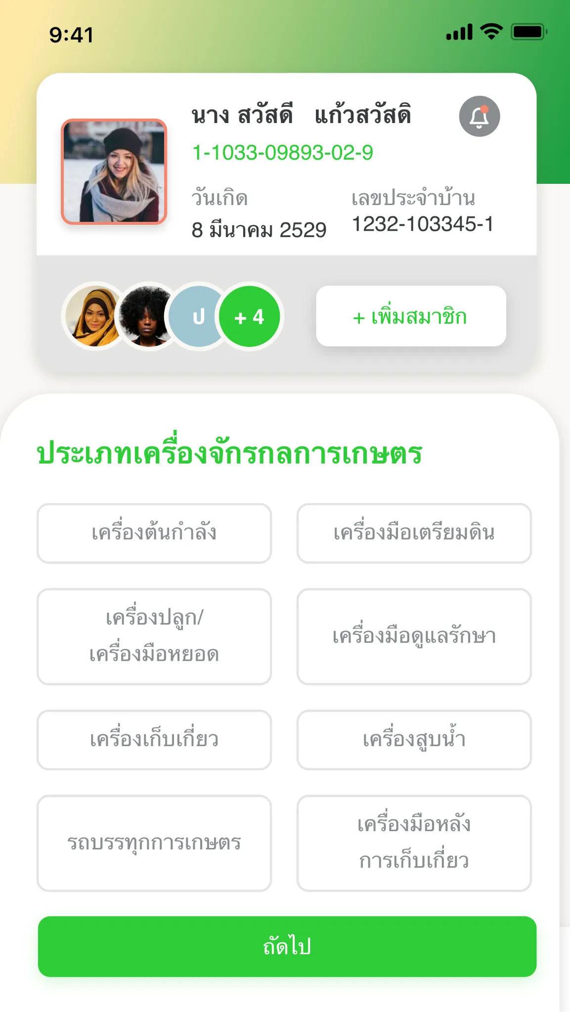
2. Agricultural Machinery and Tools

Grouped by type: power units, tools / auxiliary tools, soil preparation tools, crop care tools, harvesting tools, water pumps, agricultural trucks, post-harvest tools

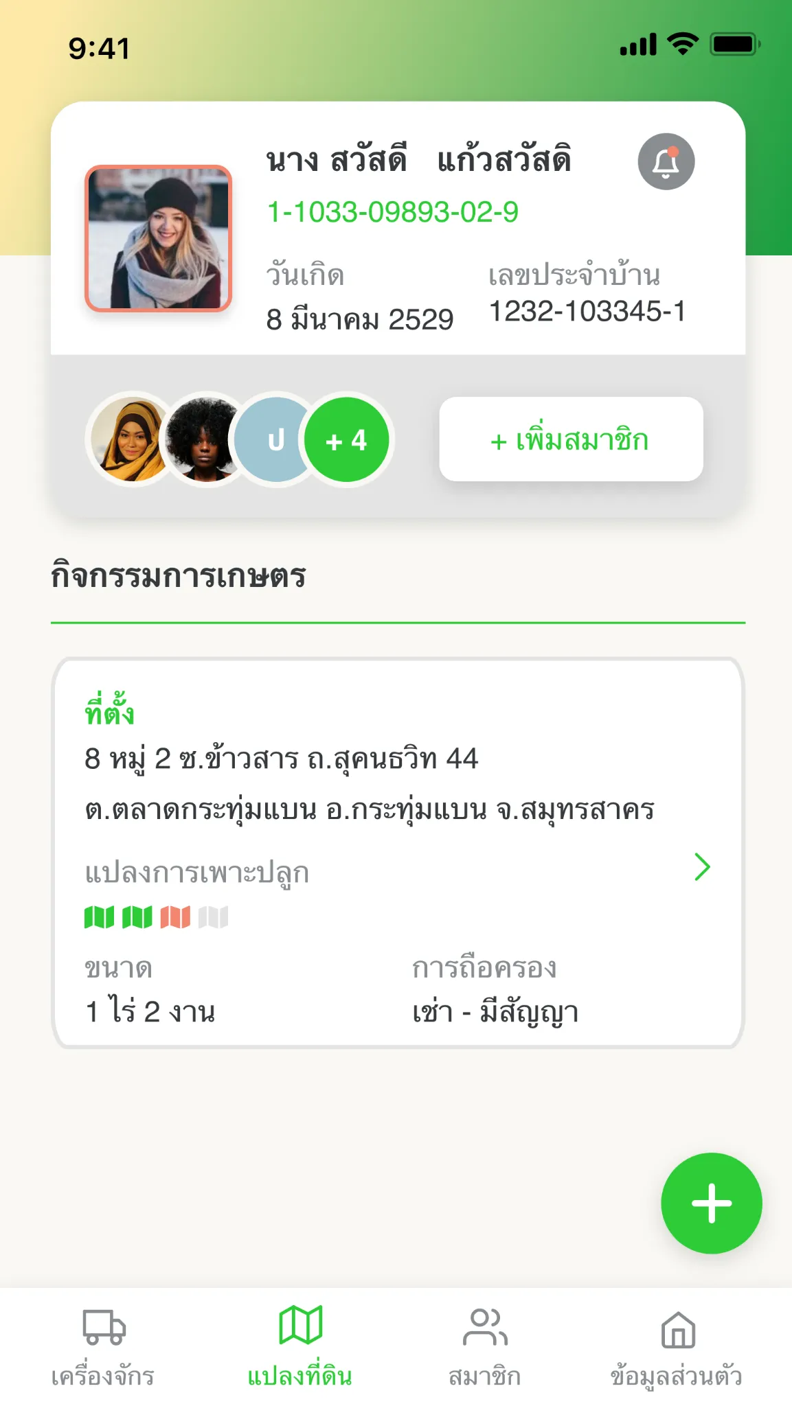
3. Agricultural Activities

  • Location (address, province)
  • Cultivation plots (map)
  • Plot size (rai–ngan), land tenure (rented / under contract)

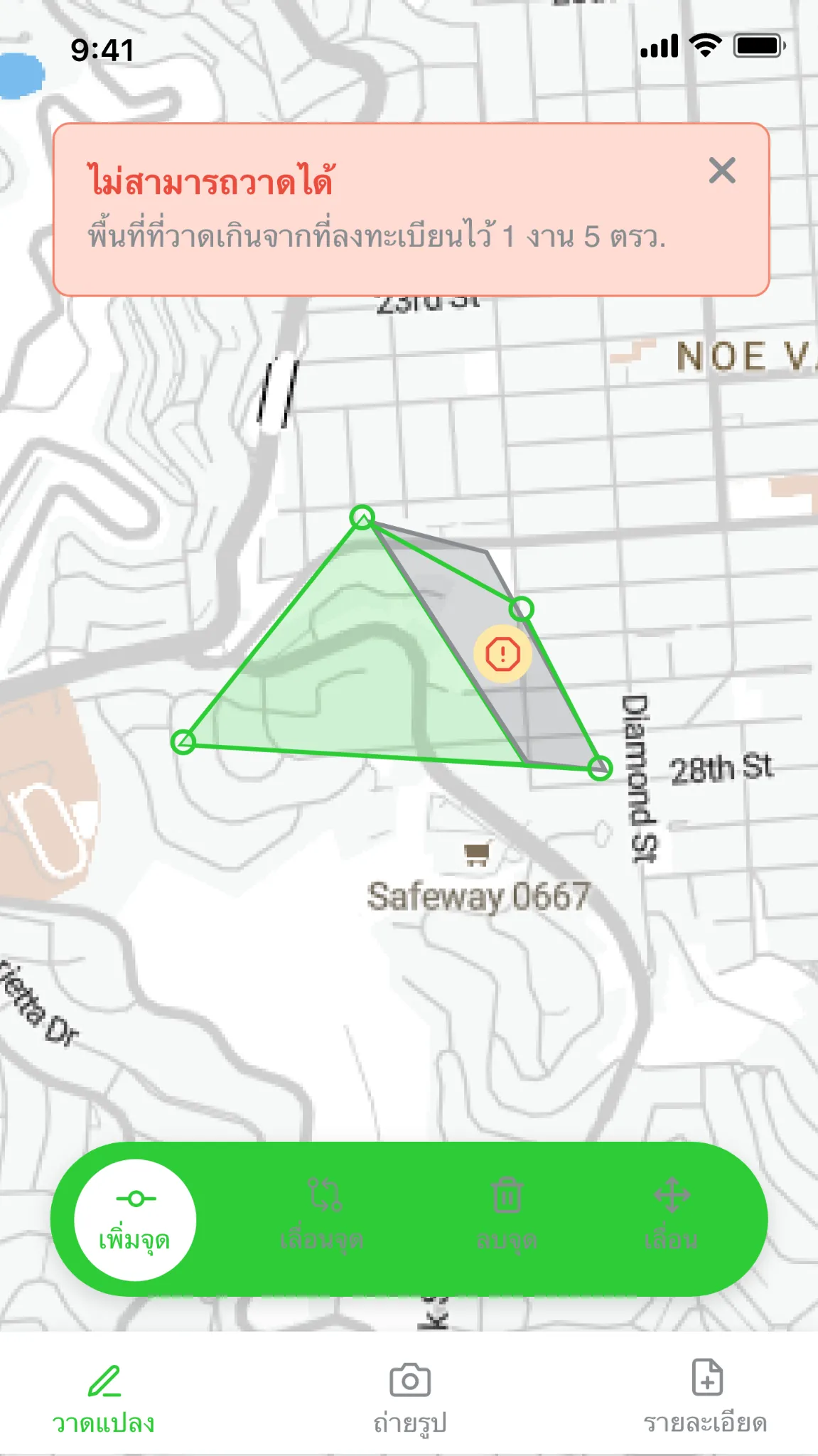
4. Map and Land Boundaries

  • Draw plot boundaries on the map as polygons
  • Validation: checks that a drawn plot does not overlap land that is already registered (e.g. the error “Cannot draw: the drawn area overlaps land that is already registered”)
  • Evidence photos, GPS tag

Sample Screens

The screens below use placeholder data, not real farmer records.
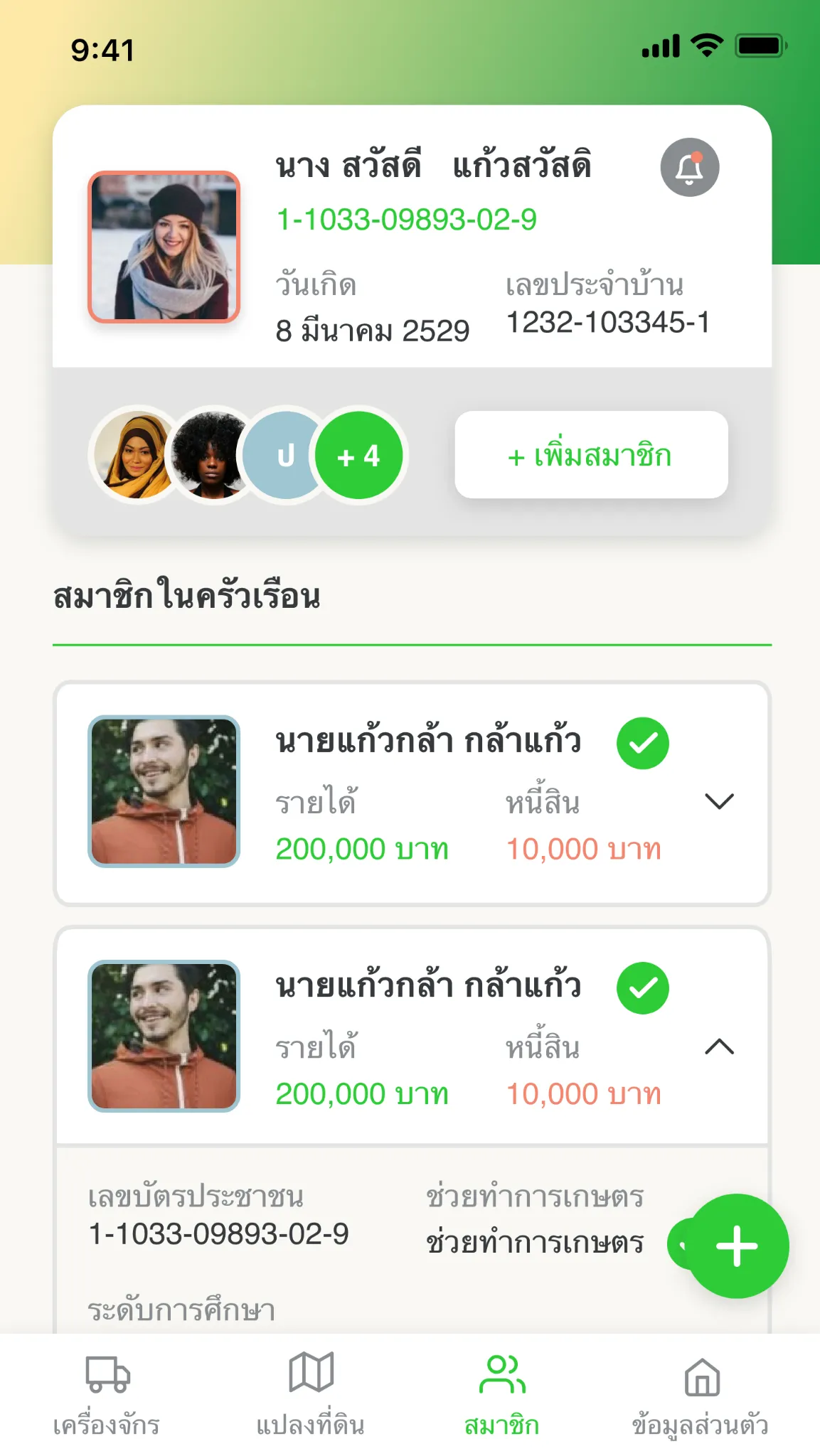
Household screen with sample data: head-of-household card with date of birth and house registration number, and a list of household members showing income and debt

Map screen with sample data: a plot polygon being drawn, with a validation error that blocks the drawing

Agricultural activity screen with sample data: plot location, cultivation plots, plot size and land tenure

Machinery screen with sample data: choosing the type of agricultural machinery

Want us to build something like this for your organization?

Book a free consultation with the BIGGO team. We will design a solution tailored to your problem, on your terms.

hello@biggo-analytics.com We reply within 1 business day.